
Drone survey cost is the question we get asked before anything else, and the honest answer is “it depends on the site.” That’s not a dodge. A 6-acre pad site off Beltway 8 and a 300-acre tract in Fort Bend County are two different jobs with two different price tags, even though both end up as an orthomosaic and a surface model. What follows are Houston market estimates, not our rate card. Use them to budget. Then get a quote on the actual parcel.
Drone survey cost by site size in Houston
These ranges come from what we see quoted across the Houston market for photogrammetry work with ground control. Treat them as a starting point.
A small site under 10 acres, which covers most retail pads, self-storage lots, church expansions, and single-building commercial parcels, usually lands between $1,200 and $3,000. That buys you an orthomosaic, a digital surface model, contours, and the raw imagery.
Mid-size sites from 10 to 50 acres run roughly $3,000 to $7,500. Subdivisions in the planning stage, industrial yards, and school campuses fall here. Price moves with the number of control points and how much of the site is tree canopy, which photogrammetry handles poorly.
Per-acre pricing on large tracts
Above 50 acres, pricing usually flips to a per-acre basis. Expect $40 to $150 per acre depending on accuracy requirements, and it keeps dropping as acreage climbs. A 500-acre ranch tract priced per acre will be far cheaper per unit than a 60-acre site, because mobilization is the same either way.
Corridor work (pipeline right-of-way, drainage channels, roadway segments) is priced per mile instead. Figure $1,500 to $4,000 per mile for photogrammetry. The number swings on access, airspace, and how many property owners you need permission from.
LiDAR and stockpile pricing
LiDAR is its own line. Drone LiDAR in Houston generally runs $150 to $500 per acre, with the high end reserved for engineering-grade vertical accuracy under vegetation. If you’re asking for LiDAR, you probably already know why you need it. If you’re not sure, you probably need photogrammetry.
Stockpile volumetrics are typically $500 to $1,500 per visit depending on how many piles and how large the yard is. Monthly or quarterly recurring flights get discounted because the setup is already done.
Everything above assumes the drone survey cost you’re being quoted is for a mapping product, not a certified survey. That distinction matters in Texas, and it affects price. More on that below.
What moves drone survey cost
Acreage is the obvious one, but it’s not the biggest one on small sites. On a 5-acre job the drive time, airspace authorization, and ground control setup cost more than the flight itself.
Accuracy and ground control
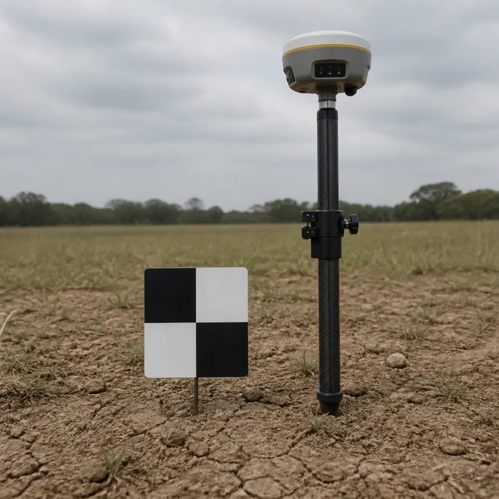
Accuracy is where the real money sits. A map that’s good to a few inches horizontally and used for planning or progress tracking is one thing. A topographic surface that an engineer will design drainage against is another. The second one needs more ground control points, an RTK-equipped aircraft like a DJI Matrice 4 Enterprise or Mavic 3 Enterprise with the RTK module, and a check-point report that proves the accuracy. That report is what you’re paying for. The ASPRS Positional Accuracy Standards for Digital Geospatial Data are the usual yardstick. Ask any provider which accuracy class they’re delivering to. If they don’t know what you mean, keep looking.
Vegetation changes the math too. Photogrammetry sees the top of the canopy, not the dirt under it. On a wooded tract in Montgomery County you either accept that the surface model is the treetops, fly in winter when the leaves are off, or move to LiDAR. Nobody can give you a bare-earth model from photos of a pine stand.
Houston airspace
Airspace is a Houston-specific cost most people don’t think about. A big slice of the metro sits inside Class B airspace for Bush Intercontinental and Hobby, plus the Class D rings around Ellington, Sugar Land, and Hooks. Flights in those areas need FAA LAANC authorization, and in some grids the approved altitude is capped low enough that the pilot has to fly more lines to cover the same ground. More lines, more flight time, more images to process. It’s not a huge adder on most jobs, but a 100-foot ceiling near Hobby can turn a one-battery site into a three-battery site.
Deliverables are the last lever on drone survey cost. An orthomosaic and a surface model are the baseline. Contours at 1-foot intervals, a classified point cloud, cut-and-fill against a design surface, or a CAD-ready file in your engineer’s coordinate system all add processing time. Ask for what you’ll use. Skip what you won’t.
The surveying question nobody wants to answer
Here’s the part that trips up buyers. A drone mapping deliverable is not a land survey, and in Texas only a Registered Professional Land Surveyor can certify one. The Texas Board of Professional Engineers and Land Surveyors regulates that, and they’re not shy about it.
What that means in practice: a drone operator can fly your site, process the imagery, and hand you a highly accurate map and surface model. What they can’t do is sign it as a boundary survey, set property corners, or stamp a topographic survey for permitting. For those, the drone data goes to a licensed surveyor who ties it to monuments, checks it, and puts their seal on it.
Plenty of Houston projects use drone mapping exactly this way. The surveyor gets a denser, faster dataset than a crew walking the site with a rover. The owner pays for one drone flight plus the surveyor’s review instead of three days of field crew. The savings are real on anything over 20 acres. On a 2-acre lot, honestly, just call the surveyor.
So when you compare drone survey cost against a conventional topo quote, make sure you’re comparing the same deliverable. A $2,500 drone map and a $9,000 sealed topographic survey aren’t competing products. One is often an input to the other.
Where drone mapping beats a ground crew
Progress tracking is the clearest win. A GC on a 40-acre site can get a fresh orthomosaic every two weeks for less than one day of a survey crew, and the whole project team can pull it up from their desks. Once the building envelope is up, the same flight schedule can fold in a commercial exterior inspection without a second mobilization. We wrote about how that works on active Houston jobs in our post on drone progress monitoring for construction.
Stockpiles, raw land, and places you can’t walk
Earthwork and stockpiles are the next one. Measuring a pile with a drone takes a few minutes of flight and gives you a volume you can defend. Walking it with a rod is slower and less accurate on anything with an irregular shape. If you’re being invoiced on moved yardage, drone volumetrics pay for themselves on the first disputed ticket.
Pre-design existing conditions on larger tracts is another. A developer looking at raw land in Waller or Brazoria County can get a full-site orthomosaic, drainage patterns, and an elevation model for a few thousand dollars before committing to a full survey. It’s cheap due diligence. Our construction drone mapping post gets into the deliverables in more detail.
And anything that’s hard or unsafe to walk. Detention ponds full of water, active rail yards, refinery laydown areas. The drone doesn’t care. It’s the same reason aerial inspections took off in this market: the aircraft goes where a person shouldn’t have to.
How to get an accurate quote fast
The fastest way to pin down drone survey cost is to send the parcel. A Harris County Appraisal District link, a KMZ, or even a screenshot with the boundary drawn works. Then answer three things: what you’ll use the map for, what accuracy you need (planning-grade or engineering-grade), and whether a surveyor will be stamping it. That last answer changes the workflow, so it’s better to know up front.
If you have a design surface or an engineer’s coordinate system, send that too. Delivering in the right projection the first time saves everyone a round trip.
You can see the full scope of what we fly on our drone mapping services page, or just send us the site and we’ll come back with a number.
Related questions
How much does a drone survey cost per acre in Houston?
For photogrammetry on tracts over 50 acres, Houston market pricing is roughly $40 to $150 per acre, with the per-acre rate dropping as acreage increases. Small sites under 10 acres are usually quoted as a flat project fee between $1,200 and $3,000 rather than per acre. LiDAR runs $150 to $500 per acre.
Is a drone survey the same as a land survey?
No. A drone mapping deliverable is geospatial data. A land survey is a certified document that only a Texas Registered Professional Land Surveyor can seal. Drone data is often used as an input to a survey, but the drone operator can’t certify boundaries or stamp a topo on their own.
How accurate is a drone survey?
With RTK positioning and surveyed ground control, drone photogrammetry can reach horizontal accuracy of an inch or two and vertical accuracy within a few inches on open ground. Accuracy drops under tree cover, where LiDAR is the better tool. Ask the provider to report accuracy against checkpoints.
Do I need FAA authorization to have a drone survey done near a Houston airport?
The operator does, not you. Most of inner Houston sits in controlled airspace, and the pilot has to get LAANC authorization before flying. A legitimate provider handles that as part of the job. If a provider tells you airspace isn’t an issue near Hobby or IAH, that’s a red flag.
Why does drone survey cost vary so much between providers?
Mostly accuracy and deliverables. A quick orthomosaic with no ground control is cheap and fine for marketing or rough planning. A controlled, checked, engineering-grade surface with a documented accuracy report costs more because it takes more field time and more processing. The two aren’t the same product, even if both get called a drone survey. Our drone roof inspection cost post walks through the same logic on the inspection side, and it applies here too: you’re paying for what the data is good for, not for the flight.