Droneshouston

construction progress monitoring

Construction drone mapping aerial view of a commercial development site
Blog

Drone Mapping Services for Construction Projects in Houston

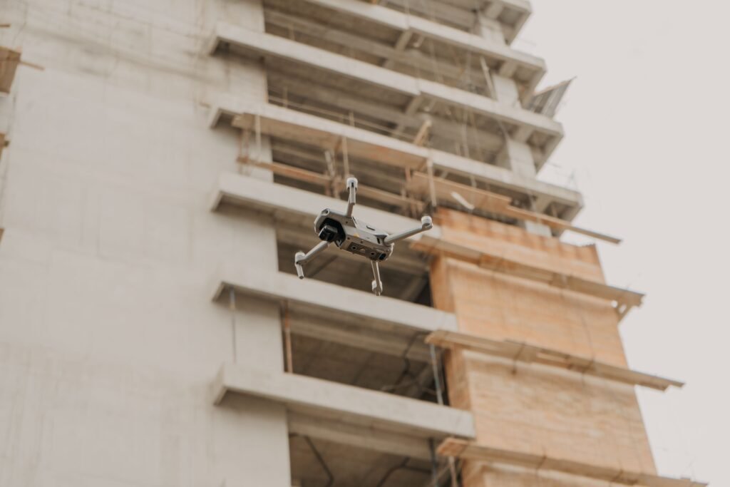
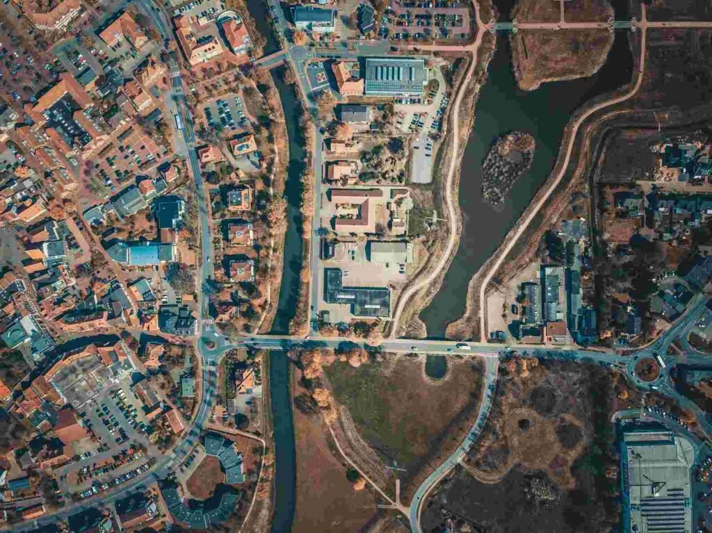
Houston projects move fast, sprawl wide, and require project teams to make decisions without every stakeholder on-site.Construction drone mapping gives project teams a reliable way to track activity, verify progress, and share current site conditions with owners, lenders, and contractors. Drone mapping services in Houston close the visibility gap. Teams use current aerial data during meetings, pay applications, and claims reviews to make more informed decisions. Weather is a major factor in Houston construction. Heavy rain, sudden wind shifts, and post-storm cleanup can delay schedules. Timestamped aerial documentation helps teams verify site conditions and support project records. Owners and lenders want confidence without extra site visits. Subcontractors need clear information about access routes, laydown yards, and sequencing. This becomes even more important when crews rotate between multiple projects due to labor shortages. What Drone Mapping Services in Houston Actually Deliver Drone mapping is more than aerial photos. The value comes from a repeatable process that captures the same coverage the same way over time, so teams can see what changed, when it changed, and what it affects. A proper mapping program shows installed work, staged materials, and blocked areas. It also creates a defensible audit trail for change orders, delays, and scope disputes. Most Houston construction teams use a mix of visual documentation and measurable mapping outputs. The choice depends on whether the question is “what happened?” or “how much changed?” Baseline deliverables typically include nadir imagery, oblique imagery, site walkthrough video, and panoramas from key vantage points. Teams that need measurements can use photogrammetry outputs such as orthomosaics, 3D models, point clouds, and DSM or DTM surfaces for grading and drainage analysis. Progress Mapping Weekly or biweekly aerial mapping creates a consistent record for construction progress monitoring, owner reporting, and lender visibility.. Our drone mapping services are built around repeatable capture standards. Each flight produces data that teams can compare directly with previous collections. When the same views repeat every week, side-by-side comparisons become obvious and the conversation shifts from opinions to evidence. Annotated maps are among the most-used deliverables. Pin-based issue tracking ties field notes to specific locations, then feeds into progress reports that owners and project managers can review without a site visit. Orthomosaic and 3D Deliverables High-resolution orthomosaics support plan overlays, layout verification, and clearer communication than unstructured photo folders. Teams can use georeferenced orthomosaics immediately in CAD, BIM, and GIS platform A 3D model, point cloud, and digital surface model help teams evaluate grading, structure context, and changing site geometry over time. These outputs also support stockpile measurements, earthwork calculations, and site logistics tracking so teams can monitor haul routes, crane pads, and material staging more accurately. For roof and facade reviews, our aerial inspection services and thermal imaging services extend the same workflow into hard-to-access areas with less field exposure than manual checks. Common Construction Uses for Drone Mapping Drone mapping supports many construction activities beyond simple progress photos. Houston contractors use aerial mapping for earthwork tracking, stockpile measurements, site logistics planning, and pre-construction documentation. Teams also use mapping for lender draw inspections, change orders, subcontractor coordination, and post-storm assessments. Current site data helps project teams identify issues earlier. It also improves stakeholder communication and supports better decision-making. As projects grow more complex, regular aerial mapping creates a centralized visual record. Owners, contractors, and consultants can use that record to stay aligned throughout the construction process. When You Need Mapping vs. Visual Documentation Use mapping when the question is quantifiable. If you need quantities, distances, grading progress, or overlay analysis against design, an orthomosaic, point cloud, or 3D model is the right tool. Use visual documentation when the question is communicative. Progress photos, walkthrough videos, and annotated snapshots help owners, stakeholders, and lenders understand current site conditions. Teams typically use these deliverables to improve visibility rather than perform precise measurements. Many projects use both. The cadence and deliverable mix should match how fast the site changes and what decisions are coming up in the next two weeks. Houston Airspace and Flight Planning Sites near George Bush Intercontinental Airport, William P. Hobby Airport, and the Houston Ship Channel often require LAANC authorization that shapes the entire collection schedule. Crane picks, concrete pours, and active traffic control also affect when a safe and complete flight is possible. Local planning matters before launch, not after. All ISKY operations are conducted by FAA Part 107 certified pilots who handle airspace coordination, site safety planning, and geofencing before every mission. Getting Started with Drone Mapping in Houston The most useful mapping cadence is usually regular, not reactive. Consistent flights build a site record that supports pay applications, inspection reviews, and post-weather recovery documentation in ways that one-off flights cannot. If your team needs clearer progress records, better quantity visibility, or more reliable site documentation, request a project review . Learn more about our services: Drone Mapping Â· Aerial Inspections Â· Thermal Imaging Â· Photography & Videography

Construction progress monitoring drone capturing a commercial building project in Houston
Blog

How Construction Companies Use Drone Progress Monitoring in Houston

Construction progress monitoring can prevent a small oversight on a 40-acre job site from turning into a week of schedule risk once concrete, steel, and trades stack on top of it. Many Houston builders now rely on drone construction monitoring instead of occasional site visits because recurring documentation keeps owners, lenders, and project teams aligned. As a result, stakeholders can review progress quickly and make informed decisions without constantly being on-site. Why Drone Progress Monitoring Matters on Houston Job Sites Houston projects move fast, sprawl wide, and involve distributed stakeholders who cannot all be on-site when decisions are made. Construction progress monitoring solves the visibility gap by creating remote site visibility that is consistent enough to trust in meetings, pay apps, and claims. Weather is a real driver here, not a footnote. Heavy rain events, sudden wind shifts, and storm cleanup create weather delays that are easy to argue about and hard to prove without timestamped documentation. Progress monitoring is more than aerial photos. The value comes from a shared visual record that is captured the same way over time, so teams can see what changed, when it changed, and what it affects. Owners and lenders want confidence without adding site visits. Subcontractors want clarity on access, laydown yard changes, and sequencing, especially when labor shortages force crews to rotate across multiple projects. What “Progress Monitoring” Means (Not Just Drone Photos) Progress monitoring means recurring drone flights that produce consistent, comparable deliverables over time. Instead of a one-off flight, you get timeline storytelling, measurement, and verification of completed work that supports decisions. A proper program shows what was installed, what is staged, and what is blocked. It also creates a defensible audit trail for change orders, delays, and scope disputes. What Data Drones Capture for Construction Progress Most Houston teams use a mix of visuals and mapping. The choice depends on whether the question is “what happened?” or “how much changed?” The baseline deliverables typically include nadir imagery (straight-down), oblique imagery (angled), site walkthrough videos, and panoramas from key vantage points. For construction progress monitoring that requires measurements, photogrammetry processing can produce an orthomosaic, a 3D model, and a point cloud. It can also generate DSM and DTM surface products for grading and drainage analysis when needed. These outputs support stockpile measurements, earthwork calculations, and site logistics tracking. Teams can monitor haul routes, crane pads, and material staging more effectively. They also support documentation for pay applications, change orders, and stakeholder updates. In addition, construction progress monitoring provides site-wide context and shows conditions on specific dates. Progress Deliverables Stakeholders Actually Use Weekly photo sets with matched camera angles are the workhorse deliverable. When the same views repeat every week, side-by-side comparisons become obvious, and the conversation shifts from opinions to evidence. Annotated maps are the next most-used tool. Pin-based issue tracking helps field-to-office collaboration by tying notes to locations, then pushing those notes into a progress report that owners and PMs can review quickly. When You Need Mapping vs. Just Visual Documentation Use mapping when the question is quantifiable. If you need quantities, distances, grading progress, or overlay analysis against design, an orthomosaic, point cloud, or 3D model is the right tool. Use visual-only packages when the goal is communication. Executive updates, marketing documentation, and general stakeholder reporting often need clarity and consistency more than survey-grade outputs. How Recurring Drone Flights Create a Reliable Visual Timeline Most Houston commercial and civil teams schedule weekly flights because they align with meeting cadence and improve change detection. In some cases, fast-moving industrial projects, shutdown windows, or major concrete cycles may require daily flights. Smaller projects, however, can often rely on milestone-based captures. For construction progress monitoring, consistency matters more than volume. A repeatable flight path, consistent altitude, matching camera angles, and similar lighting conditions make week-to-week changes easier to interpret. By contrast, one-off flights often create noise and limit meaningful comparisons. Standardized missions create reliable comparisons that support schedule discussions, verify percent completion, and reduce rework. In addition, simple standards help teams save time later. Use naming conventions, date-stamped folders, and version control to keep deliverables organized. As a result, teams can quickly locate the correct documentation during a claim, audit, or stakeholder review. Standardizing Flight Paths and Camera Angles Mission planning tools let pilots replicate routes and overlap settings, which improves alignment for photogrammetry and makes visuals comparable. This is where matched camera angles pay off, because stakeholders start recognizing the same “corners” of the project every week. Pick a handful of fixed “hero” viewpoints. These might include the main site entrance, a long-axis view over the building pad, and a high oblique angle that captures the laydown yard, access roads, and crane operations. Cadence Planning for Houston Weather and Site Access Plan for missed days. Building buffer weeks around storm seasons and high-wind days keeps the monitoring program consistent even when the calendar is not. Coordinate flights with the superintendent’s plan of the day. Avoid peak site traffic, active crane picks, and high-risk operations, and schedule around major pours so imagery shows clear pre-pour and post-pour conditions. Step-by-Step Workflow: From Flight to Progress Report A repeatable workflow turns drone data into actionable decisions. For construction progress monitoring, most teams follow four steps: pre-flight planning, data capture, processing, and publishing with a concise narrative. Pre-flight planning starts with clear objectives. First, define whether the deliverable will support visual documentation, mapping, construction inspections, or pay application verification. Then establish site boundaries and create a safety plan. Next, follow a documented mission plan during data capture. Use consistent camera settings and log site conditions for every flight. When measurement accuracy is important, deploy ground control points to support mapping and overlay analysis. After capture, processing converts raw imagery into usable deliverables. This step includes image stitching, map generation, 3D model creation, and quality control reviews. As a result, deliverables remain consistent from one reporting period to the next. Finally, publishing determines whether stakeholders actually use the information. Share deliverables through cloud collaboration

Scroll to Top